Research Projects
|
|
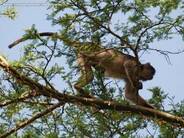
Collective Movement Ecology
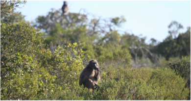
Movement and grouping patterns of social animals under changing environments
The recent and rapid developments in geospatial infrastructure, e.g., remote sensing (RS), geographical information systems (GIS), and global positioning systems (GPS), has transformed our ability to understanding of the drivers behind the movement and grouping patterns of wildlife. I develop and use this geospatial infrastructure to collect animal movement data, fit statistical movement models, and simulate mobile social networks, to provide a means of linking collective movement behaviour to environmental conditions. I use insights gained from these studies to better understand the implications of landscape alterations, the evolution and development of social structures, as well as the spread of infectious disease.

|
|
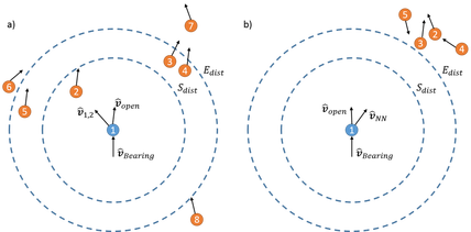
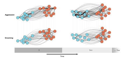
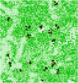
Dynamic social networks
Evolution, development, and function of social structures
Social wildlife species, such as non-human primates, are ideal study species to better understand how social systems respond to environmental change. To study these social species I develop statistical, machine learning, and simulation based tools to study dynamic social networks, and to test hypotheses about how these social networks develop. The insights from the development and application of these tools to social wildlife groups have been used to better understand collective movement and the evolution and function of social structures.
|
|
|
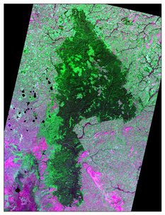
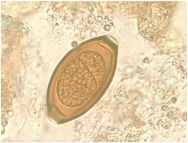
Spatial epidemiology
Landscapes, host behaviour, and infectious disease
Infectious disease propagation in wildlife is thought to be influenced by landscape structure, host behaviour, and parasite characteristics. These factors, however, are often studied in isolation. I use field data along with geospatial simulation to better understand the interactions between landscapes-hosts-parasites. In these geospatial simulations, I combine spatial and behavioural data by integrating agent-based modeling and geographical information systems. Agent-based modeling approaches are ideal for examining complex interconnected systems that exhibit phenomena like self-organization, emergence, or path dependency. Geographical information systems provide a structured environment, which is ideal for analyzing and representing complex spatial patterns. Their combination offers the ability to examine complex systems in a spatially-explicit way. In using these computational approaches, my aim is to develop geospatial simulation methodology to better understand landscape-host-parasite systems, as well as a tool for making site specific predictions.
|
|
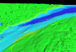
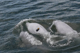
Social-Ecological Systems
Geospatial simulations of complex adaptive systems
Ecological systems can no longer be considered to be independent from anthropogenic influences. I'm interested in using geospatial simulations to better understand and manage social-ecological systems to mitigate these influences. A prominent project I'm currently involved with looks to manage the St. Lawrence Estuary for both cetaceans and marine traffic. A key component of this simulation is estimating noise exposure between ships and cetaceans under alternative traffic scenarios, which requires a good understanding of the collective movement behaviors and habitat use of cetaceans. By using a simulation approach it is possible to incorporate knowledge from multidisciplinary teams (e.g., economists, physicists, ecologists, geographers) to both come up with management recommendations, but also to help guide future research aims.
